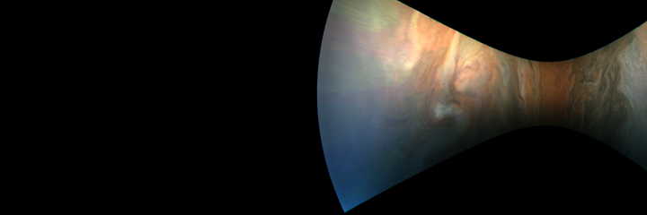
Upload 2018-03-28: JunoCam Perijove 04, cylindrical map of image #102, 180 pixels per planetocentric degree, cropped to the range from 30 degrees southern to 30 degrees northern latitude, and to the range from 80 to 100 degrees western L3 longitude, north is to the right
#00102
#00102
Terms of Use
The images are allowed to be treated as being in the public domain.
However, crediting the images to "NASA / SwRI / MSSS / Gerald Eichstädt",
appears appropriate.
Add your name or data sources to the credit list, whenever you create derived works.
Downloading, viewing, distributing the files, as well as creating derived work is on your own risk.